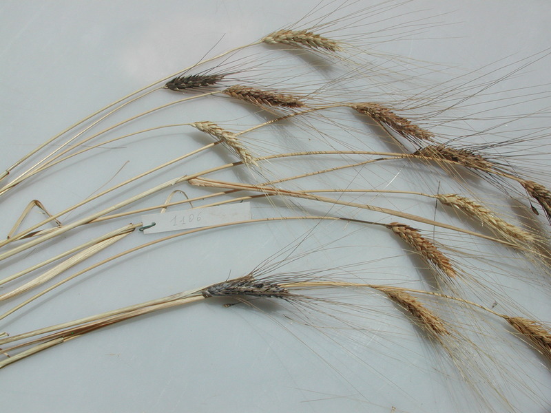
MGD Accession #1106
DOI: https://doi.org/10.71582/b72f-3e83
GENESYS-PGR record: 15a6f653-5b4e-4bdf-aa8e-90285dfdc838
EURISCO record: ITA436:MGD0001106:TRITICUM
BioMemory Record: BM-101-001106
GBIF dataset: ITA436-MGG-Triticum

(click on the above images to enlarge them)
Passport Data
| MCPD v.2.1 |
FIELD NAME |
VALUE | LEGEND |
|---|---|---|---|
| 2 | ACCENUMB | 1106 | Unambiguous identification number for the accession |
| - | accecode | MGD0001106 | Accession unique label |
| - | taxon_id | 4571 | Species code at the NCBI Taxonomy (Bio-sequence data) |
| - | family | Poaceae | Latin name of the family |
| - | binomial | Triticum turgidum | Full latin name of the species |
| 5 | GENUS | Triticum | Genus latin name |
| 6 | SPECIES | turgidum | Species latin name |
| 7 | SPAUTHOR | L. | Standard abbreviation of the author who described the species |
| 8 | SUBTAXA | Subsp. Durum | Any additional taxonomic identification (subsp., convar., var., f., spp.) |
| 9 | SUBTAUTHOR | Desf.) Van Slageren | Standard abbreviation of the author who described the subtaxon |
| - | subsp | - | Subspecies name (old notation) |
| 10 | CROPNAME | Wheat | Commom crop name (former cultivar localname) |
| 11 | ACCENAME | Noris | Official accession name recorded |
| - | origin | Israel | Country of origin of the material |
| 13 | ORIGCTY | ISR | ISO code of the original country where the accession was collected |
| 3 | COLLNUMB | PI 168693 | Original number assigned to the accession by the collector |
| 4 | COLLCODE | - | FAO code of the institution that collected the sample |
| 14 | COLLSITE | Ancient Palestine | Locality of the sampling site |
| 18 | COLLDATE | - | Collection date |
| 15 | LATITUDE | - | Latitude of the sampling site (decimal) |
| 16 | LONGITUDE | - | Longitude of the sampling site (decimal) |
| 17 | ELEVATION | - | Elevation of the sampling site (m a.s.l.) |
| 22 | COLLSRC | - | Source of the material |
| - | aspect | - | Magnetic declination (in degrees from N) of the slope (if any) at the collection site taken with a magnetic compass |
| - | slope | - | Slope (%) at the collection site |
| - | exped | - | Label of the expedition that collected the sample |
| - | team | - | Label of the sampling team |
| - | landform | - | Description of the surrounding landscape at the collection site |
| - | site | - | Description of the collection site |
| - | texture | - | Soil texture at the collection site |
| - | stoniness | - | Stoniness of the collection site |
| - | depth | - | Soil depth at the collection site |
| - | drainage | - | Drainage at the collection site |
| 12 | ACQDATE | 1971-01-01 | Acquisition date |
| 19 | BREDCODE | - | FAO code of the institute that create the accession |
| 20 | SAMPSTAT | - | Accession biological state |
| 21 | ANCEST | - | Pedigree |
| 23 | DONORCODE | USA138, USDA, Agricultural Research Center, Beltsville. MD, United States | FAO code of the donor institute |
| 24 | DONORNUMB | - | Accession number assigned by the donor |
| 25 | OTHERNUMB | - | Other identification numbers assigned to the accession |
| 26 | DUPLSITE | - | FAO code of the institute keeping a security duplicate |
| 27 | STORAGE | - | Conservation type of the germplam |
| 29 | COLLDESCR | - | Decodified name of the institute collecting the accession |
| 30 | BREDDESCR | - | Name (decodified) of the institute that produced the accession |
| 31 | DONORDESCR | - | Name (decodified) of the donor Institute (abbreviated name and location) |
| 32 | DUPLDESCR | - | Name of the institute where a safety duplicate is kept (abbreviated name and location) |
| 34 | MLSSTAT | 0 | Inclusion in the multilateral system (0: no; 1; yes) |
| 35 | AEGISSTAT | 0 | Inclusion in the European Integrated Genetic Bank System (AEGIS - 0: no; 1: yes) |
| 28 | REMARKS | - | General remarks on the accessions |
| 36 | GIBA1 | - | Local vernacular name |
| 37 | GIBA2 | - | Local name of the landrace |
| 38 | GIBA3 | - | Name of the person who collected/prepared the material |
| 39 | GIBA4 | 1 | Availability of the material (0: no; 1: yes) |
| - | historic | 0 | Historical accession record (0: no; 1: yes) |
QR code (H)
Barcode (C93)


